|

On eBay Now...
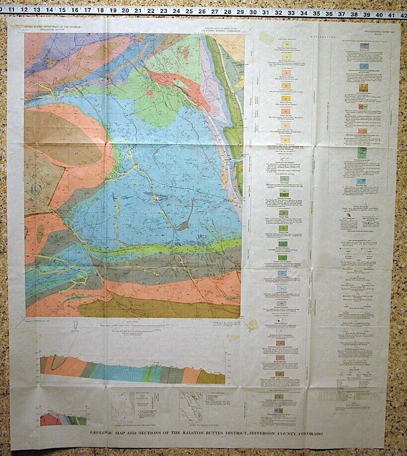
USGS COLORADO URANIUM RALSTON BUTTES, SCHWARTZWALDER MINE, ALL MAPS Near DENVER For Sale

When you click on links to various merchants on this site and make a purchase, this can result in this site earning a commission. Affiliate programs and affiliations include, but are not limited to, the eBay Partner Network.

USGS COLORADO URANIUM RALSTON BUTTES, SCHWARTZWALDER MINE, ALL MAPS Near DENVER:
$25.00
URANIUM!! HOT ITEM - BUT NOT LITERALLY!! This is USGS Professional Paper 520,Geology and Uranium Deposits of the Ralston Buttes District, Jefferson County, Colorado.Published in 1967, there aren't many of these around! The publication consists of the121-page book,alleightof the original color maps, and a large folded table of samples taken in the Schwarzwalder mine, all ofwhich come in a pocket in the back of the book.
This is an interesting area in the Front Range of Colorado west of Denver. The uranium deposits are the most significant east of the Continental divide, and unlike many Colorado uranium deposits, they are hosted by Precambrian metamorphic rocks rather than sandstones. They are vein deposits that came with a whole bunch of other interesting minerals. Some of the minerals I saw discussed in the text include:
Pitchblende Coffinite Torbernite Metatorbernite Uranophane Autunite Meta-autunite Uranopilite Johannite, Betazippeite Phosphuranylite Metazeunerite Fourmarierite Silver Nicolite Pyrite Chalcopyrite Bornite Sphalerite Galena Bismuth Copper Marcasite Maucherite Rammelsbergite Covellite Malachite Azurite Chalcanthite Hematite Emplectite Molybdenite Pyrrhotite In addition there are many minerals making up the host rocks in and near the mines. Mines and deposits discussed in the text include: Schwartzwalder mine Ascension mine Mena mine North Star mine Aubrey Ladwig mine Fork prospect Ohman mine Union Pacific prospect Buckman property Ladwig #1 through 3
Of these theSchwartzwalder, Ladwig, andAscension mines were the major producers, and each of these has one or more pocket mapsdedicatedto it. Maps of theSchwartzwaldermineinclude underground workings. They are very cool!The text goes into great detail about the host formations, their structure and mineralogy, and the structure and occurrence of mineralization in the deposits. It has all the detail you could want! The locations are given in detail. What a great item for any geologist, arm chair geologist, hiker or explorer in the Denver area! Hard to pass this one up, and it would make a great, unusual gift. Over an inch thick!! See my other items. I may have other reports on this district. This would be a great item for a mineral collector, prospector, historian, or armchair geologist looking to understand this important area better. Expert packing assured. Shipping weight is three pounds. Buyer pays exact Media Mail postage. I willcontinue to add new items to my store, so check back periodically. Expert Packing Assured. ®
ROCKWILER


USGS COLORADO URANIUM RALSTON BUTTES, SCHWARTZWALDER MINE, ALL MAPS Near DENVER $25.00

USGS MARCELLINA MOUNTAIN COLORADO GEOLOGIC MAP, Full Color, Original Sleeve 1966 $11.90

USGS WASHBOARD ROCK, COLORADO Geologic Map, COLORFUL 1987 Diverse Geology COAL $11.90

USGS IRONTON COLORADO GEOLOGIC MAP, Huge Full Color Map Original Sleeve 1964 $11.90

USGS TRAIL MOUNTAIN, COLORADO Geologic Map, COLORFUL MAP 1974 - FOSSIL LOCATIONS $11.90

USGS HAYDEN PEAK COLORADO GEOLOGIC MAP, Huge Full Color Map Original Sleeve 1970 $11.90

USGS RUDOLPH HILL, COLORADO GEOLOGIC MAP, Full Color Map Original Sleeve 1974 $11.90

USGS POUDRE PARK COLORADO GEOLOGIC MAP, Huge Full Color Map Original Sleeve 1988 $11.90
|