|
|
|

|
|

On eBay Now...
Vtg Michikamau Lake Canada World Aeronautical Chart 1947 (179) Map Decor 29x22 For Sale
 Map Decor 29x22")
When you click on links to various merchants on this site and make a purchase, this can result in this site earning a commission. Affiliate programs and affiliations include, but are not limited to, the eBay Partner Network.

Vtg Michikamau Lake Canada World Aeronautical Chart 1947 (179) Map Decor 29x22:
$13.75
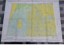
This deal is for a pre-owned 1947 World Aeronautical Chart Map of Labrador Canada's Michikamau Lake Map # 179, Second Edition August, 1947.
Date of Magnetic information 1945. Prepared at the direction of the Commanding General, Army Air Force, for the Aeronautical Chart Service by the U.S. Coast Guard and Geodetic Survey from the best sources available, including trimetrogon compilation. Lambert Conformal Conic Projection. Standard Parallels 55 degree and 65 degree. Scale 1:1,000,000.
This chart prepared for use at night under white, ultra-violet, red and amber lights.
This rectangular map arrives folded. It has a 1-1/2" horizontal rip on the left border, 1-1/2" down from the middle fold. The color is in excellent condition. The reverse side includes the Chart Index, Relief Features, Cultural Features, Hydrographic Features, and more!
This map makes a great gift or wall decor for a pilot, a hunter cabin or a resident of Labrador Canada's Michikamau Lake.
Size: 29 L x 22 W. Full Color.
We have lots of maps listed.
Fast shipping from Orlando.
Vtg Michikamau Lake Canada World Aeronautical Chart 1947 (179) Map Decor 29x22 $13.75
|
|
|

