|
|
|

|
|

On eBay Now...
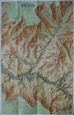
Topo Map GRAND CANYON Arizona Colorado River Lake Mead Geology Lees Ferry Trails For Sale

When you click on links to various merchants on this site and make a purchase, this can result in this site earning a commission. Affiliate programs and affiliations include, but are not limited to, the eBay Partner Network.

Topo Map GRAND CANYON Arizona Colorado River Lake Mead Geology Lees Ferry Trails:
$6.99
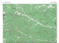
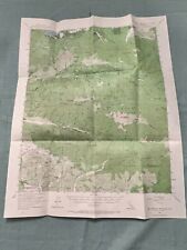
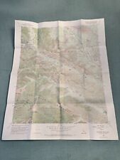
Handsomefold-out topographical map of the Grand Canyon in Arizona. - This map is lithographed in full color ontwo sides and opens to a generous 36\" x 22½\".
- It is drawn on a scaleof 1:24,000, and shows hiking trails, rapids, springs, ranger stations,campgrounds, picnic areas, ruins, cliffs, points of interest, and more.
- On the reverse side is a computer-generated mosaic of Landsat satelliteimages depicting the canyon from Lee\'s Ferry to Lake Mead, andpictographs of the canyon\'s geology.
- This Grand Canyon map was prepared by the National Geographic Society,which is noted for its highly detailed and attractive cartography. Itis dated July 1978 on the cover.
- Condition: This map is in excellent condition,bright and clean, with no marks, rips, or tears. Besure to take a look at the scans and feel free to ask any questions.
- Buy with confidence! We are always happy to combineshipping onthe purchase of multiple items — just make sure to pay for everythingat one time, not by SixBit\'s eCommerce Solution
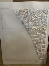
Vintage Raised Relief Topo Maps $20.00
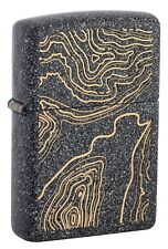
Zippo Topo Map Design Iron Stone Windproof Lighter, 211-088357 $30.95

1944 VTG Topo Map WAR DEPT Bartlett Springs Quadrangle, CA $31.87
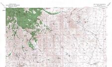
Lake Valley Quadrangle, New Mexico 1962 Topo Map USGS 15 Minute Topographic $21.99
Topo Map GRAND CANYON Arizona Colorado River Lake Mead Geology Lees Ferry Trails $6.99
Cloudcroft Quadrangle, New Mexico 1952 Topo Map USGS 15 Minute Topographic $21.99
Vintage 1954 Topographic Topo Map San Gorgonio Mountain CA US Geological Survey $14.95
Vintage 1956 Topographic Topo Map Telegraph Peak CA US Geological Survey $14.95
|
|
|

