|

On eBay Now...
KANSAS EXPLORATION LINEN MAP GUNNISON EXPEDITION SANTA FE TRAIL 1855 For Sale

When you click on links to various merchants on this site and make a purchase, this can result in this site earning a commission. Affiliate programs and affiliations include, but are not limited to, the eBay Partner Network.

KANSAS EXPLORATION LINEN MAP GUNNISON EXPEDITION SANTA FE TRAIL 1855:
$295.00
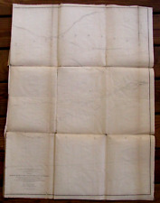
In the early 1850s the US Government decided to explore the West to select a route for a Transcontinental Railroad from the Mississippi River to the Pacific. The Army assigned skilled officers to explore various latitudes for routes, also to search for mineral deposits, report on Indian tribes, and collect natural history specimens. This Survey Reports contained detailed descriptions of the West with maps, including some large linen backed foldout maps. An original War Department Linen Backed Survey Map of explorations near the 38th and 39th Parallels \"Map No 2 From the Mouth of Trap Creek To The Santa Fe Crossing directed by Sec of War Jefferson Davis, by Capt JW Gunnison, Topographic Engr, along with his team incl Assistant Captain EG Beckwith, RH Kern Topographer in the Field, and notes the map is Made under the Supervision of Capt EG Beckwith by EW Egloffstein, Field Topog for the Route\", 1855.The map shows a scale of of 12 miles to one inch, includes portions of the the Kansas, Platte & Grand Island,The Republican, Arkansas, Pawnee & Smoky Hill Fork Rivers, also Omaha & Nebraska City, Forts Riley, Atkinson & Kearny, the Santa Fe Trail, the proposed Railroad Lines, etc. As this Survey proceeded West he Ute Indians massacred Captain Gunnison, topographer PH Kern and other members of his party, almost setting off a war with the Mormons who were blamed for the attack.Gunnison Colorado is named for Captain Gunnison .The map lower edge bears the engraver imprint of Selmar Siebert, Washington, DC. This 24 x 32\" original report cream color linen backed map has age stains, edge wear, the reverse folds with removable acid free archival repairs, Overall VG.Ex Lib.
KANSAS EXPLORATION LINEN MAP GUNNISON EXPEDITION SANTA FE TRAIL 1855 $295.00
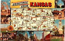
Explore Kansas: history, nature, and culture await postcard $10.75
Kansas City Star "Commemorative Edition" July 26 1969, Man on the Moon $29.99

2~4X6 Postcards Wichita, KS Kansas EXPLORATION PLACE Night View & Miniature Town $5.89

Kansas Cosmosphere and Space Center Commemorative Challenge Coin Exploration $19.99
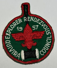
Explorer Rendezvous Quivira Council Kansas 1957 Boy Scout RC3 $11.34
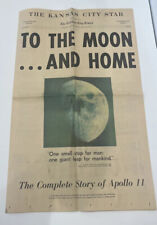
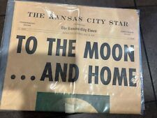
To The Moon...And Home Commemorative Edition Kansas City Star July 26, 1969 $16.25

Kansas City Star July 23, 1969 Moon Landing Advertisements Astronauts Space + $43.20
|


