|

On eBay Now...
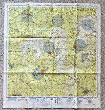
1956 Map Of Dayton Ohio US Air Force Aeronautical Chart 22” X 28 1/2” For Sale

When you click on links to various merchants on this site and make a purchase, this can result in this site earning a commission. Affiliate programs and affiliations include, but are not limited to, the eBay Partner Network.

1956 Map Of Dayton Ohio US Air Force Aeronautical Chart 22” X 28 1/2”:
$14.50
1956 Map Of Dayton Ohio US Air Force Aeronautical ChartMeasure approximately 22” X 28 1/2”In good condition. It has been fold and has folded crease lines with wear along those creases. Writing on bottom right. Please see photos.FAQsAll items are examined and every attempt is made to describe them completely and accurately.However, most items are antique/vintage, and by virtue of their age will not be perfect. Upon receipt if you have any concerns please contact me! If for any reason you are inclined to rate your experience less than five stars contact me first - lets discuss. Customer support is important to me as is your satisfaction! Combined Shipping? Yes, we do, and youwillsave $$ when you buy more than 1 item from us. Will my item be insured in transit? Yes, automatically by ShipSaver, the Post Office or Self Insurance. How will this be packed? Professionally! In bubble wrap with plenty of clean, recycled products and packaging tape for security. How can I pay? PayPalor other- Contact us if you need other payment method. Sorry, but after 7 days' of non-payment, gets involved. Any issue, please talk to us! THANK YOUfor shopping withP-B-Antiques
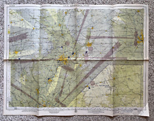
1956 Map Of Wright Field Dayton Ohio US Air Force Aeronautical Chart 29” X 31” $14.50
1956 Map Of Dayton Ohio US Air Force Aeronautical Chart 22” X 28 1/2” $14.50
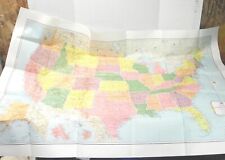
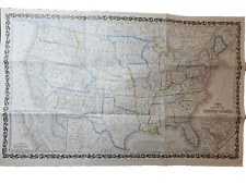
VINTAGE 1956 MAP OF THE UNITED STATES OF AMERICA USA UNUSED NICE QUALITY $49.97
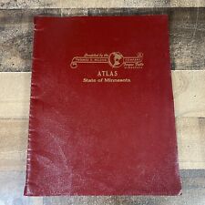
Vintage Atlas State Of Minnesota 1956 Thomas O. Nelson Co. Fergus Falls, Minn $82.17
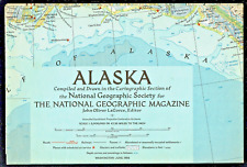
1956-6 June Vintage Original Map ALASKA National Geographic Single-side - (564) $7.00
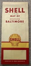
1956 Shell Road Map: Baltimore Metropolitan HTF Gas Station Map $12.50
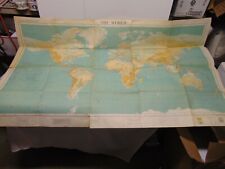
1956 American geographic Society world Map 56" x 34" 5th Edition New York $9.99
Charles DeSilver Reproduction A New Map of The United States Rand McNally 1956 $29.99
|


