|

On eBay Now...
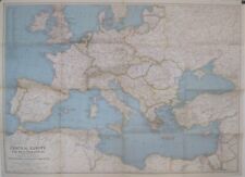
1939 Map CENTRAL EUROPE & MEDITERRANEAN Germany Poland Slovakia Palestine Levant For Sale

When you click on links to various merchants on this site and make a purchase, this can result in this site earning a commission. Affiliate programs and affiliations include, but are not limited to, the eBay Partner Network.

1939 Map CENTRAL EUROPE & MEDITERRANEAN Germany Poland Slovakia Palestine Levant:
$14.99
Large-formatfold-out 1939 map of Central Europe and the Mediterranean,printed more than 84 years ago. - This map opens to a generous26\" x 36\" and is drawn on a scale of 1:5,000,000.
- The coverage area extends from Ireland to the VolgaRiver, south to Libya and thecoast of northern Africa.
- Detailsinclude cities, towns, railroads, canals, natural features, andpolitical boundaries, some of whichare very different from today\'s.
- There is no Austria. Along with the western part ofCzechoslovakia, it had been annexed by Germany the yearbefore this map was printed.
- Poland\'s Baltic coastline is shown as shorter than it istoday, although the country\'s overall land area has been greatlydiminished.
- In the Middle East an area labeled Palestine occupieswhat is Israel today. North and east of Palestine arethe Levant States and Trans-Jordan.
- The map wascompiled by the Cartographic Division of the National GeographicSociety, and it was issued as a supplement to the magazine in October1939.
- Condition: It is in excellent condition,bright andclean, with no marks, rips, or tears. It is blankon the back, with no printingon the reverse side, and it folds to 9\" x 6¾\". Please see the scans andfeel free to ask any questions.
- Buy with confidence! We are always happy to combineshipping on thepurchase of multiple items — just make sure to pay for everythingat one time, not individually.
Powered by SixBit\'s eCommerce Solution

1939-10 October Map CENTRAL EUROPE & MEDITERRANEAN National Geographic - (943) $18.00
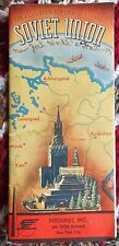
Intourist Soviet Union Map 1939 Russia Tours $10.00

Vintage 1939 Arizona Official Road Map – State Highway Department $18.99
1939 Map CENTRAL EUROPE & MEDITERRANEAN Germany Poland Slovakia Palestine Levant $14.99
WWII Heart Shield Gold-Plated Soldier's Pocket Bible “May This Keep You Safe…” $150.00
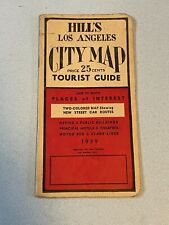
Vintage 1939 HILL'S Los Angeles City Map Tourist Guide Booklet (No map) $9.99

1939 ORIGINAL MAP / NEVADA CITY CALIFORNIA / LINEN-BACKED / GOLD RUSH COUNTRY $115.00

1939 Shell Gas & Oil State Road Map: COLORADO H.M. Gousha Litho $15.00
|


