|

On eBay Now...
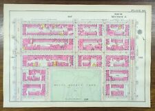
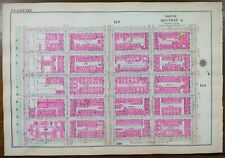
1916 MOUNT SINAI HOSPITAL CENTRAL PARK MANHATTAN NEW YORK CITY NY Street Map For Sale

When you click on links to various merchants on this site and make a purchase, this can result in this site earning a commission. Affiliate programs and affiliations include, but are not limited to, the eBay Partner Network.

1916 MOUNT SINAI HOSPITAL CENTRAL PARK MANHATTAN NEW YORK CITY NY Street Map :
$200.88
"An Authentic Original Map Not A Reproduction" Offered for your consideration is a beautiful antique original hand-colored map showing the Mount Sinai hospital neighborhoods bordering Central Park to the east. Bounded by Central Park and 5th avenue to the west, 3rd avenue to the east, E105th street to the north, and E100th street to the south. This antique 16 1/2" x 11 1/2" map printed on heavy paper is in GOOD condition with light tone, soil and edge wear as shown in pictures, from the Atlas of New York City, Borough of Manhattan ©1916 by G.W. Bromley, also known as the Land Atlas. On the reverse is a map of the adjoining neighborhood directly to the east as shown in the last 4 pictures. A copy of the title page is included with your purchase to verify authenticity. SHIPPING: Your map will be shipped in a sturdy waterproof tube with USPS tracking. Please view our happy customer response and buy with complete confidence. Please view our other 1,000 plus maps for sale in our store. We sell antique and vintage original maps only, no reproductions. Thank you
1916 Mount Vernon IL Louis Emmerson for Secretary of State Political Campaign $75.00
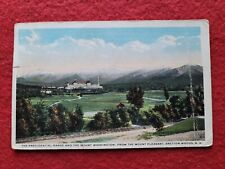
1916 Mount Pleasant Bretton Woods New Hampshire $3.19
1916 MOUNT MORRIS PARK MANHATTAN NEW YORK CITY Street Map ~ 127th St - 122nd St $200.88
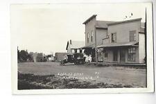
1916 Mount Sterling, Wisconsin Looking East RPPC $18.00
1916 MOUNT SINAI HOSPITAL CENTRAL PARK MANHATTAN NEW YORK CITY NY Street Map $200.88
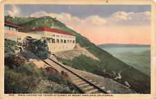
TRAIN LEAVING TAVERN AT SUMMIT MOUNT TMALPAIS CA VINTAGE POSTCARD 1916 102423 S $6.39
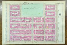
Vintage 1916 MARCUS GARVEY MOUNT MORRIS PARK MANHATTAN NEW YORK CITY Land Map $200.88
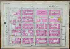
1916 CARNEGIE HILL MOUNT SINAI MANHATTAN NEW YORK CITY NY Street Map E95th-100th $201.56
|


