|

On eBay Now...
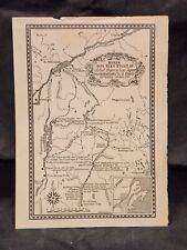
1759 Map| Map of the fort and fortress at Crown Point with their environs. With For Sale

When you click on links to various merchants on this site and make a purchase, this can result in this site earning a commission. Affiliate programs and affiliations include, but are not limited to, the eBay Partner Network.

1759 Map| Map of the fort and fortress at Crown Point with their environs. With:
$34.99
Map Size: 18 inches x 24 inches | Fits 18x24 size frame | Frame not included | Archival Quality Reproduction | 1759 Map|Title: Map of the fort and fortress at Crown Point with their environs. With the disposition of the English Army under the command of Genl. Amherst encamp'd there 1759|Subject: Crown Point|Crown Point N.Y|Fortification|French and Indian War|History, Manuscript|New York State|United States Notes: Scale 1:7,200; 200 yards to an in. Manuscript, pen-and-ink and watercolor. Relief shown by shading and hachures. Includes "References."Each Map is Hand Printed in our StudioFine Art Matte Paper (230g, 14mil) that maintains vivid colors and faithfulness to the original map.Archival inks guaranteed not to fade for 200+ yearsYour map will be shipped in a protective tube via first class mail
Powered by SixBit's eCommerce Solution
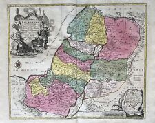
Israel Palestine Holy Country Map Card Carte Engraving Copperplate 1759 $279.58
1759 - Russia Asia Asian Map Card Copperplate $45.46
1938 Map Major Robert Rogers Rangers British Army 1759 Expedition to St. Francis $14.99
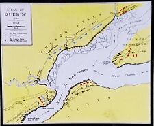
1910, Siege of 1759 Map, Quebec (Canada) And Vicinity, Magic Lantern Glass Slide $6.95
Early Georgia Weather & Havre De Grace English Channel Map 1759 old UK Magazine $92.00
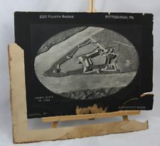
Rare Historic Fort Pitt in 1759 Map, copyright 1905 Antique 3D Relief Lithograph $675.00

1759, January, Hungary / Hungary, antique map, antique map. $386.60
1759 LONDON MAGAZINE Antique History VIZCAINO CALIFORNIA VOYAGE / GUADELOUPE MAP $195.00
|


