|

On eBay Now...
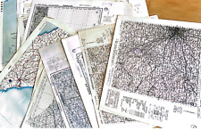
Vintage Map Collection (1950-2000) AAA Rand McNally, & More US & Canada 30+ Maps For Sale
 AAA Rand McNally, & More US & Canada 30+ Maps")
When you click on links to various merchants on this site and make a purchase, this can result in this site earning a commission. Affiliate programs and affiliations include, but are not limited to, the eBay Partner Network.

Vintage Map Collection (1950-2000) AAA Rand McNally, & More US & Canada 30+ Maps:
$19.99
Explore a treasure trove of history with this extensive lot of over 30 maps, spanning from 1950 to 2000. This collection includes a diverse range of geographical areas, offering detailed views from city streets to scenic highways across the United States and Canada.
Included in this lot are:
- State and city maps by AAA covering Illinois, Indiana, New York, Washington, Nevada, Utah, Arizona, New Mexico, Colorado, Wyoming, Alberta, and British Columbia.
- Specialized maps from Rand McNally, including Philadelphia and San Mateo/Redwood City.
- Unique finds such as the Roadmap to Lost Mines and Buried Treasures of California, and several Chamber of Commerce maps for cities like San Jose, Redlands, and Santa Cruz.
- Vintage street guides and official state highway maps with recreational highlights
Please note: This collection is ideal for collectors, historians, or anyone with a passion for geography and vintage maps. Photos are available to illustrate the general condition of these maps. Consider this unique lot for your collection or as a thoughtful gift for a map enthusiast.
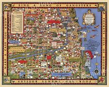
1931 Chicago Gangland Map Historic Vintage Style Wall Gangster Map - 24x30 $23.95
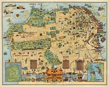
San Francisco 1927 Odd Historic Map - 16x20 $13.95
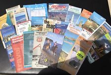
Lot of 17 - Various Vintage State Old Road Maps - Group 6 $14.99
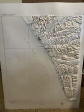
Vintage Raised Relief Topo Maps $20.00
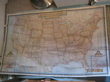
VINTAGE THE UNITED STATES OF AMERICA WALL MAP National Geographic June 1951 $3.95
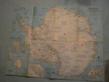
VINTAGE ANTARCTICA MAP National Geographic February 1963 $2.95

Vintage Map Lot of 9 $15.00
HUGE Lot 24 Vintage Map War Office WW2 World War 2 Maps Unique Vintage WWii $210.00
|


