|

On eBay Now...
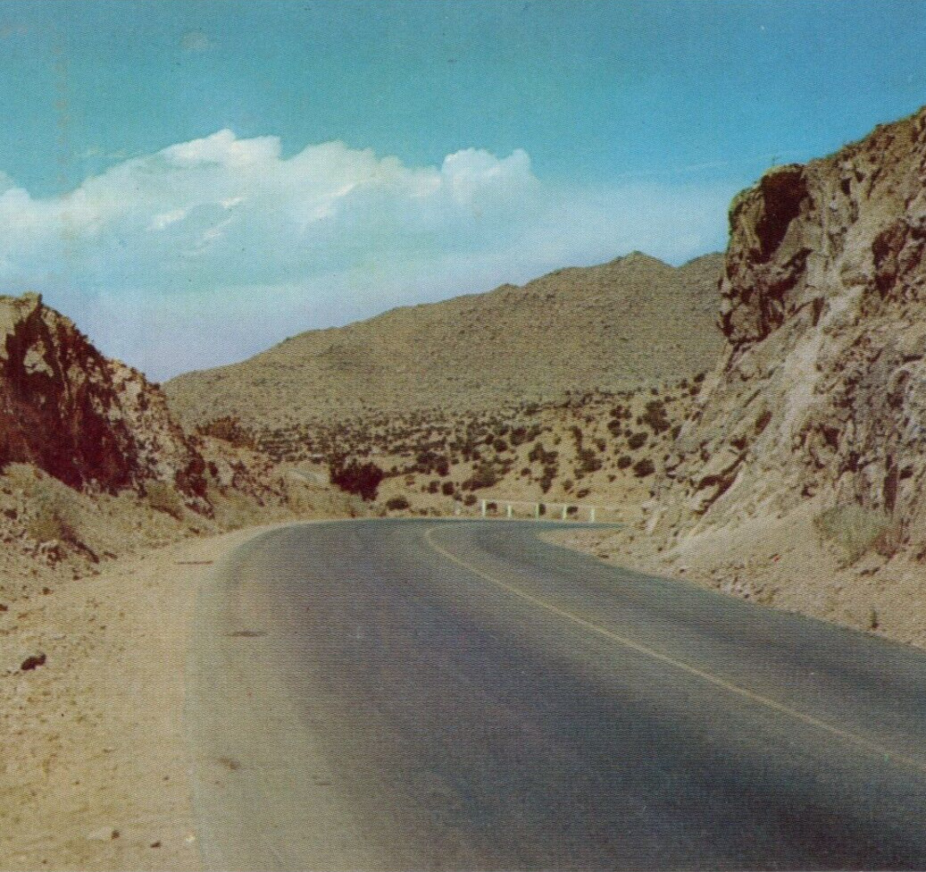
Route 66 & Tijeras Canyon, Rocks Highway, Vista 1950 Vintage Postcard Unposted For Sale

When you click on links to various merchants on this site and make a purchase, this can result in this site earning a commission. Affiliate programs and affiliations include, but are not limited to, the eBay Partner Network.

Route 66 & Tijeras Canyon, Rocks Highway, Vista 1950 Vintage Postcard Unposted:
$7.99
OC-K164 K-29 VISTA THROUGH THE ROCKS IN TIERAS CANYON ON U. S. HIGHWAY 66 EAST OF ALBUQUERQUE,Bernalillo County, NEW MEXICO This interesting Vista is one of the many scenic sights, the traveler enjoys on his trip east or west over Highway 66.
DISTRIBUTED BY SOUTHWEST POST CARD CO. BOX 685. ALBUQUERQUE, “CURTEICHCOLOR” REPRODUCTION FROM KODACHROME ORIGINAL.
"Tijeras Canyon (sometimes also referred to as Tijeras Pass) is a prominent canyon in the central part of the U.S. state of New Mexico. It separates the Sandia Mountains subrange to the north from the Manzano Mountains subrange (specifically the lower "Manzanitas" subrange) to the south. These subranges are part of the larger Sandia–Manzano Mountains; Tijeras Canyon forms a pass through this range. Elevations along the bottom of the canyon range from 5,600 feet (1,700 m) to 7,000 feet (2,100 m) above sea level. The canyon drains to the west, into a large dry wash known as Tijeras Arroyo, which runs through Kirtland Air Force Base, passes just south of the Albuquerque International Sunport, and then joins the Rio Grande. The arroyo heads at the historically important pass (approximately 7,040 feet (2,150 m)), and this pass and the entire canyon are traversed by Interstate 40, following the path of historic U.S. Route 66. (Route 66 originally passed through Santa Fe and entered Albuquerque from the North. In 1937 Governor Arthur Hannett re-routed the road away from Santa Fe and through Tijeras Canyon as revenge on politicians who he perceived had thwarted his re-election.) A railroad, the Albuquerque Eastern Railway, was proposed to run through the Canyon in 1901, connecting to the New Mexico Central at Moriarty, with a branch to the coalfields around Hagan. Some grading for the trackbed was done (still visible at places near the western mouth) but tracks were never laid in the canyon, and the project was abandoned in 1908. The name Tijeras means "scissors" in Spanish, and the name is said to come from the junction of two tributary canyons, or perhaps of two roads. The name is most properly applied only to the small village, Tijeras, at the junction, as the original name of the canyon was Cañon de Carnué. However the name Tijeras is now almost universally applied to the canyon. The original inhabitants of the canyon were Pueblo people, occupying Tijeras Pueblo near the site of the present-day town of Tijeras, but the site has long been deserted. The cement plantThe largest employer in the Canyon is a cement plant which opened in the late 1950s. Its buildings and excavations dominate the portion of the canyon and surrounding hills southwest of the town of Tijeras. In 1950, the Tijeras Canyon job was the largest road project ever let in the State of New Mexico. It also carried the honor of being the first U. S. Route 66 four-lane divided highway built in New Mexico. Skousen, Isbell & Johnston Contracting Company was awarded the contract. The job reached completion in 1951. The project extended from Albuquerque's eastern city limits to roughly a mile east of Tijeras." - Wikipedia "Where Route 66 meets the Turquoise Trail Site of Zuzax Tijeras is a small community on Route 66 in New Mexico's Tijeras Canyon; it is flanked by the Sandia and Manzano Mountains. It is located on an ancestral trail, on the crossroads of Route 66 and the The Turquoise Trail.
It has its share of ancient historic sites, nature and Route 66 landmarks, below we list them:
The 14th century Historic Tijeras Pueblo Prehistoric Sandia Cave archaeological site Zuzax Molly's Bar Historic Tijeras Canyon marker The Oasis site (gone) Carlito Springs Historic Santo Niño Church Take a side trip to drive along the Sandia Crest Scenic Byway and the ancient trails of the Salt Missions Scenic Byway to get the feel of New Mexico and its history." -www.theroute-66.com/tijeras.htm


ROUTE 66 MOTEL keytag $4.99

VINTAGE US ROUTE 66 PORCELAIN GASOLINE AMERICA ROAD GAS SERVICE PUMP PLATE SIGN $125.37

OWL COURTS, BRITTON, OKLAHOMA – Route 66 – 1940s Linen Postcard $3.00

Gold Road Gold Mining Ghost Town Arizona Route 66 Photo Postcard printed 1994 $10.00

Route 66 mapVintage Souvenir Postcard $3.50

ROUTE 66~ BAXTER SPRINGS, KS ~ SPRING RIVER ~ postcard~ 1930s $3.00

Large ROUTE 66 METAL SIGN 36"x 32" $125.00

Elephant Park near Williams, Arizona on Route 66- 1908 d/b Postcard- Fred Harvey $49.99
|