|

On eBay Now...
Original Map of the Federal Steel Company Controlling B, C, D, E and F from 1899 For Sale

When you click on links to various merchants on this site and make a purchase, this can result in this site earning a commission. Affiliate programs and affiliations include, but are not limited to, the eBay Partner Network.

Original Map of the Federal Steel Company Controlling B, C, D, E and F from 1899:
$19.00
THE BOOKFACTORWorldwide ShippingstoreCombined ShippingOriginal Map of the Federal Steel Company Controlling B, C, D, Eand F from 1899 Any reasonable offer acceptedI combine shipping, please give me 1 business day to send an updated invoice. If You need more Photos Please send me an EmailThis map is original and rare - came from a financial book dated 1899. There is some edge wear on one side which can easily be trimmed and Framed. Maps are very fragile. It will be shipped in a cardboard backing with plastic covers. I have a large collection of these railroad maps - if you are looking for a paticular one please let know. Dimensions: 7.75" x 12.5"Binding: mapDust Cover?: N/APrice Clipped?: N/ADust Cover Condition: N/ACondition Interior: GOODCondition Exterior: GOODEx-Library?: noWriting in Book? noPublisher: Year: 1899Number of pages: ~1No Reasonable Offer RefusedSKU: 27964 Original Map of the Federal Steel Company Controlling B, C, D, E and F from 1899DescriptionThis map is original and rare - came from a financial book dated 1899. There is some edge wear on one side which can easily be trimmed and Framed. Maps are very fragile. It will be shipped in a cardboard backing with plastic covers. I have a large collection of these railroad maps - if you are looking for a paticular one please let know. Dimensions: 7.75" x 12.5"
Binding: map
Dust Cover?: N/A
Price Clipped?: N/A
Dust Cover Condition: N/A
Condition Interior: GOOD
Condition Exterior: GOOD
Ex-Library?: no
Writing in Book? no
Publisher:
Year: 1899
Number of pages: ~1
No Reasonable Offer Refused
SKU: 27964 About accept payment by any of the following pay as soon as possible after winning an sale or purchasing a store item, as that will allow us to post your item to you sooner! If you purchase more than one item, please give me 24 hours to combine shipping.
If you are not 100% satisfied with your purchase, you can return the product and get a full refund or exchange the product for another one, be it similar or not.
You can return a product for up to 30 days from the date you purchased it.
Any product you return must be in the same condition you received it and in the original packaging. Please keep the receipt. Any reasonable offer accepted I combine shipping, please give me 1 business day to send an updated invoice. If You need more Photos Please send me an Email This map is original and rare - came from a financial book dated 1899. There is some edge wear on one side which can easily be trimmed and Framed. Maps are very fragile. It will be shipped in a cardboard backing with plastic covers. I have a large collection of these railroad maps - if you are looking for a paticular one please let know. Dimensions: 7.75" x 12.5" Binding: map Dust Cover?: N/A Price Clipped?: N/A Dust Cover Condition: N/A Condition Interior: GOOD Condition Exterior: GOOD ​Ex-Library?: no Writing in Book? no Publisher: Year: 1899 Number of pages: ~1 No Reasonable Offer Refused SKU: 27964 Original Map of the Federal Steel Company Controlling B, C, D, E and F from 1899 Description This map is original and rare - came from a financial book dated 1899. There is some edge wear on one side which can easily be trimmed and Framed. Maps are very fragile. It will be shipped in a cardboard backing with plastic covers. I have a large collection of these railroad maps - if you are looking for a paticular one please let know. Dimensions: 7.75" x 12.5" Binding: map Dust Cover?: N/A Price Clipped?: N/A Dust Cover Condition: N/A Condition Interior: GOOD Condition Exterior: GOOD ​Ex-Library?: no Writing in Book? no Publisher: Year: 1899 Number of pages: ~1 No Reasonable Offer Refused SKU: 27964 About Us THE BOOKFACTORWorldwide ShippingCombined ShippingstoreOriginal Map of the Federal Steel Company Controlling B, C, D, Eand F from 1899 Any reasonable offer acceptedI combine shipping, please give me 1 business day to send an updated invoice. If You need more Photos Please send me an EmailThis map is original and rare - came from a financial book dated 1899. There is some edge wear on one side which can easily be trimmed and Framed. Maps are very fragile. It will be shipped in a cardboard backing with plastic covers. I have a large collection of these railroad maps - if you are looking for a paticular one please let know. Dimensions: 7.75" x 12.5"Binding: mapDust Cover?: N/APrice Clipped?: N/ADust Cover Condition: N/ACondition Interior: GOODCondition Exterior: GOODEx-Library?: noWriting in Book? noPublisher: Year: 1899Number of pages: ~1No Reasonable Offer RefusedSKU: 27964 Original Map of the Federal Steel Company Controlling B, C, D, E and F from 1899DescriptionThis map is original and rare - came from a financial book dated 1899. There is some edge wear on one side which can easily be trimmed and Framed. Maps are very fragile. It will be shipped in a cardboard backing with plastic covers. I have a large collection of these railroad maps - if you are looking for a paticular one please let know. Dimensions: 7.75" x 12.5"
Binding: map
Dust Cover?: N/A
Price Clipped?: N/A
Dust Cover Condition: N/A
Condition Interior: GOOD
Condition Exterior: GOOD
Ex-Library?: no
Writing in Book? no
Publisher:
Year: 1899
Number of pages: ~1
No Reasonable Offer Refused
SKU: 27964 About Us
PAYMENT
We accept payment by any of the following pay as soon as possible after winning an sale or purchasing a store item, as that will allow us to post your item to you sooner! If you purchase more than one item, please give me 24 hours to combine shipping. SHIPPING
RETURNS
If you are not 100% satisfied with your purchase, you can return the product and get a full refund or exchange the product for another one, be it similar or not.
You can return a product for up to 30 days from the date you purchased it.
Any product you return must be in the same condition you received it and in the original packaging. Please keep the receipt. Any reasonable offer acceptedI combine shipping, please give me 1 business day to send an updated invoice. If You need more Photos Please send me an EmailThis map is original and rare - came from a financial book dated 1899. There is some edge wear on one side which can easily be trimmed and Framed. Maps are very fragile. It will be shipped in a cardboard backing with plastic covers. I have a large collection of these railroad maps - if you are looking for a paticular one please let know. Dimensions: 7.75" x 12.5"Binding: mapDust Cover?: N/APrice Clipped?: N/ADust Cover Condition: N/ACondition Interior: GOODCondition Exterior: GOODEx-Library?: noWriting in Book? noPublisher: Year: 1899Number of pages: ~1No Reasonable Offer RefusedSKU: 27964 Original Map of the Federal Steel Company Controlling B, C, D, E and F from 1899DescriptionThis map is original and rare - came from a financial book dated 1899. There is some edge wear on one side which can easily be trimmed and Framed. Maps are very fragile. It will be shipped in a cardboard backing with plastic covers. I have a large collection of these railroad maps - if you are looking for a paticular one please let know. Dimensions: 7.75" x 12.5"
Binding: map
Dust Cover?: N/A
Price Clipped?: N/A
Dust Cover Condition: N/A
Condition Interior: GOOD
Condition Exterior: GOOD
Ex-Library?: no
Writing in Book? no
Publisher:
Year: 1899
Number of pages: ~1
No Reasonable Offer Refused
SKU: 27964 About Us

Original 1890 Antique Map ARIZONA NEW MEXICO Alamogordo Farmington Tucson Tempe $26.80
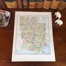
Original 1890 Antique Map LOUISIANA ARKANSAS MISSSISSIPPI Baton Rouge Vicksburg $26.80
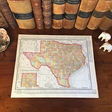
Large Original 1898 Antique Map TEXAS Austin Houston Plano Irving Laredo Lubbock $39.20
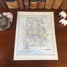
Original 1890 Antique Map ALABAMA Montgomery Florence Auburn Athens Oxford Selma $26.80
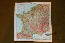
WW2 D-Day Zones of France silk Invasion Escape Map (Reproduction) $50.00
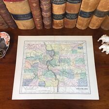
Original 1890 Antique Map COLORADO Boulder Westminster Longmont Loveland Aurora $26.80

Original 1891 Antique Map MAINE Waterville Westbrook Belfast Calais Bangor Saco $26.80

Original 1890 Antique Map OHIO Columbus Youngstown Parma Dublin Mason Kent Stow $26.80
|


