|

On eBay Now...
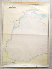
MARINE MAP / Straits of Jubal and Tiran 1993 Saudi Arabia For Sale

When you click on links to various merchants on this site and make a purchase, this can result in this site earning a commission. Affiliate programs and affiliations include, but are not limited to, the eBay Partner Network.

MARINE MAP / Straits of Jubal and Tiran 1993 Saudi Arabia:
$32.30
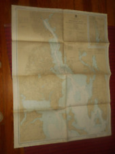
Détroits de Jubal et de Tiran
Mer Rouge édité par le Service Hydrographique et Océanographique de la Marine, 1991 et corrigée jusqu'en 1993carte au 1/175.000 environ 120x85cm, couleur Carte un peu froissée en bord sinon BON ETAT (même si pli au milieu) envoi roulée
822
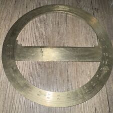
Vintage Brass Full Circle Protractor Circular 8” Topography Map Nautical Rare $69.95
Marine Map USSR Navy Black Sea Maritime Antiques Military Russian Rare Old Yacht $111.00
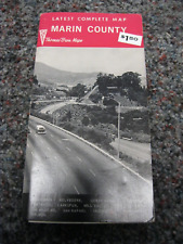
Thomas Bros 1960's map Latest complete map Marin County $12.00
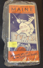
1930 Census Tydol Veedol Tide Water Oil Road Map Of Maine Maritime Provinces $12.00

1950s US Marine Corp Officers Map Orienteering Planning Vintage Military Photo $12.50
NOAA NAUTICAL CHART MAP PROVIDENCE RIVER & HEAD OF NARRAGANSETT BAY #13224 4'x3' $65.00
Marine Map USSR Navy Black Sea Bulgarian coast Military Russian Rare Old Antique $111.00
1968 Cape Hatteras, Nautical Map/ Chart 1232, C&GS, 44”x36” $29.99
|


