|

On eBay Now...
Antique Chart Number and Nationality Immigrants Arriving United States 1882 1891 For Sale

When you click on links to various merchants on this site and make a purchase, this can result in this site earning a commission. Affiliate programs and affiliations include, but are not limited to, the eBay Partner Network.

Antique Chart Number and Nationality Immigrants Arriving United States 1882 1891:
$149.00
Item:Number and Nationality of Immigrants Arrived in the United States during the Ten Fiscal Years (July 1st to June 30th) 1882 to 1891.
Year: Data published in late 1890s.
Depicts: This chart in red, yellow, and green shows circles representing the number of immigrants. It breaks it down into country of origin including Germany, Great Britain and Ireland, Norway and Sweden, Austria Hungary, Poland, etc.
On Reverse: The reverse side of this print shows the Rand McNally\'s map of the United States showing the Increase and Decrease of Population, 1880 to 1890. It shows the eastern half of the country.
Size:Page size is about 11\" x 14\". Printed area is about 9\" x 12\". Plenty of margin to mat and frame this item for display.Medium: Wax Engraving
About this Item:This is an original antique item from the Rand, McNally and Company Universal Atlas of the World: Containing Colored Maps of Every Country and Civil Division upon the Face of the Globe with Marginal Index together with Historical, Descriptive, and Statistical Matter Pertaining to Each, Ready Reference Lists to the United States, Colored Statistical Diagrams, and City Maps, also a Concise Review, Richly Illustrated by Engravings, of the World\'s Peoples. Published by Rand, McNally and Company, Publishers, Chicago, New York, USA. Copyright 1899, 1898, 1897, 1896,1895, 1894, 1893, 1892 by Rand, McNally & Co.
This is not a reprint or digital print. This is a unique collectible item from the late 1890s showing original aging.
From a collection of Antique Maps, World Maps, and Antique Statistical charts and tables.
Condition: This is an antique original print from a book. These items generally are in very good to excellent condition. Each specific item does shows typical signs of aging and wear for antique paper stock. There may be small blemishes, creases, small tears, or other wear to the sides of the page. See pictures for condition.
Shipping:This item ships flat with rigid material for protection. Buying multiple maps and charts from our collection? We can combine shipping.
About Rand McNally:Rand McNally started in 1868. They first focused on timetables and rail guides. Their first wax engraving map was printed in an 1872 railway guide. By 1880, they published numerous globes, wall maps and geography texts. Their first automobile road map was published in 1904. Today, they are one of the leading map publishers in the world.
CHECK OUT OUR OTHER ANTIQUE MAPS AND CHARTS!We had the good fortune to acquire a small collection of antique maps. Check out our other map Finds has hundreds of vintage, antique, and other items available for

Antique handpainted biological wall chart - Flea & Disease. France. 54"x43" $100.00

Antique handpainted biological wall chart - mosquito & malaria. France. 52"x43" $90.00

Antique vintage biological wall chart - conifer pines 42"x34" water damage $38.50

Vintage 1893 ASTRONOMICAL CHART Map 14"x11" Old Antique Original MOON PHASES $28.04
ANTIQUE MEDICAL CHART RED CROSS NURSE DR MAW'S CLINICAL EARLY 1900 CHART $11.42

Antique Ancient Masonic Chart Symbols Print Chromolithograph 6x4" Freemasonry $199.99
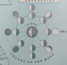
Vintage 1900 ASTRONOMICAL CHART Map 14"x11" Old Antique Original MOON PHASES $38.84
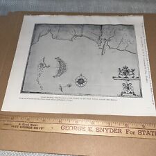
Antique Plate: Chart Showing Position of Fleet in Action Against Spanish Armada $59.00
|


