|

On eBay Now...
2006 Map of World | World Map | Map of World Map Reproduction | Vintage World M For Sale

When you click on links to various merchants on this site and make a purchase, this can result in this site earning a commission. Affiliate programs and affiliations include, but are not limited to, the eBay Partner Network.

2006 Map of World | World Map | Map of World Map Reproduction | Vintage World M:
$34.99
Map size: 18 inches x 2 feet (60.96cm x 45.72cm) | Ready to frame in standard size frame (18x24) | Frame not included | Archival quality reproduction2006 Map World Peters World map A much more controversial Map distributed by the firm ODT in Amherst, Massachusetts, is a world Map | based on the Peters Projection. This projection was popularized by Arno Peters, a 20th-century German historian, who was dissatisfied with the Mercator projection. The latter was originally developed in the late 16th century primarily for navigational purposes but was used widely throughout the 19th and 20th centuries for general reference maps. Peters argued that the Mercator projection grossly exaggerates the importance of the countries in the northern hemisphere, i.e. the well developed, industrialized countries, at the expense of the third world countries in South America, Africa, and southern Asia. Since these countries are located in the equatorial regions, there is minimal exaggeration of their areas. In place of the Mercator projection, Peters advocated the use of a projection that is known technically as the Gall equal-area projection, but is now popularly known by his name. This projection preserves relative area or size throughout the entire map, but in doing so, it distorts the shapes of continents and countries. At first glance, it is quite obvious that shapes are so distorted that it reminds one of standing in front of a mirror in a fun house. Soon after Peters presented his projection, it was adopted for use in maps by a number of social agencies such as the World Council of Churches, UNESCO, and UNICEF to graphically present a more equitable distribution of social and demographic data. The English edition of this projection is subtitled, \"The Map | which represents countries accurately according to their surface areas.\" In the marginal text, the publishers further explain that the Peters projection is \"superior in its portrayal of proportions and sizes\" and \"its importance goes far beyond questions of cartographic accuracy.
Powered by SixBit\'s eCommerce Solution
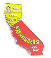
Northern California Pathfinders Camporee 2006-2007 CA Map Lapel Pin Green Red... $14.99
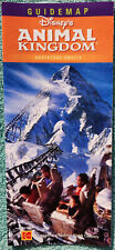
Expedition Everest Grand Opening At Disney's Animal Kingdom - 2006 Map & Guide $3.00

2006 Architectural Traditions Hudson River Valley NY Official Map Guide Series $12.99
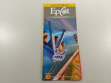
2006 walt disney world Epcot Guide map $8.62

Adventure Maps Jackson Hole Trail Map Biking Hiking Waterproof 2006 $9.99
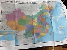
LARGE WALL MAP OF CHINA 2006 $9.99
2004 2006 AAA Florida State Series Map $466.00
2006 Map| Eurasia| Eurasia, Outline and Base Map Size: 20 inches x 24 inches |Fi $34.99
|


