|

On eBay Now...
1869 Map| Bird\'s eye view of the city of Saint Charles, St. Charles Co., Missour For Sale

When you click on links to various merchants on this site and make a purchase, this can result in this site earning a commission. Affiliate programs and affiliations include, but are not limited to, the eBay Partner Network.

1869 Map| Bird\'s eye view of the city of Saint Charles, St. Charles Co., Missour:
$34.99
Map Size: 18 inches x 24 inches | Fits 18x24 size frame | Frame not included | Archival Quality Reproduction | 1869 Map|Title: Bird\'s eye view of the city of Saint Charles, St. Charles Co., Missouri 1869|Subject: Missouri|Saint Charles|Saint Charles Mo|United States Notes: Perspective map not drawn to scale.Each Map is Hand Printed in our StudioFine Art Matte Paper (230g, 14mil) that maintains vivid colors and faithfulness to the original map.Archival inks guaranteed not to fade for 200+ yearsYour map will be shipped in a protective tube via first class mail
Powered by SixBit\'s eCommerce Solution

1869 Map of Nantucket | Nantucket Island | Historical of Nantucket | Vintage Nan $34.99
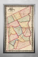
1860–1869 Map - Map of Cambria County, Pennsylvania|Notes: Relief shown by hachu $34.99

⫸ 2000-9 September WESTERN MIGRATION 1841-1869 National Geographic Map - A3 $6.00
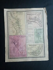
1869 Map of Bethel Vermont South Royalton VT Sharon VT Color Map Beers ORIGINAL $19.99
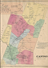
CANTON, CT., VINTAGE HAND COLORED 1869 MAP. NOT A REPRINT. $95.00
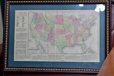
ORIGINAL 1869 MAP OF THE U.S. WITH OR WITHOUT FRAME, HAND COLORED 12" X 19" $30.00
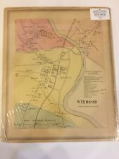
ANTIQUE 1869 WINDSOR, CT., HAND COLORED MAP. CLEAN & IN GOOD CONDITION $65.00
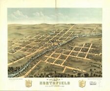
1869 Map of Northfield, Rice County, Minnesota | Bird's eye view | Minnesota Map $34.99
|


