|

On eBay Now...
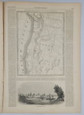
1858 Map| China| China Map Size: 18 inches x 24 inches |Fits 18x24 size frame (o For Sale

When you click on links to various merchants on this site and make a purchase, this can result in this site earning a commission. Affiliate programs and affiliations include, but are not limited to, the eBay Partner Network.

1858 Map| China| China Map Size: 18 inches x 24 inches |Fits 18x24 size frame (o:
$34.99
Map Size: 18 inches x 24 inches | Fits 18x24 size frame | Frame not included | Archival Quality Reproduction | 1858 Map|Title: China|Subject: China Notes: Entered according to Act of Congress in the year 1856 by Charles DeSilver ... . From Mitchell\'s A new universal atlas containing maps of the various empires, kingdoms, states and republics of the world. Philadelphia : Charles DeSilver, 1858. In lower left: 73. stamped on: 626888.Each Map is Hand Printed in our StudioFine Art Matte Paper (230g, 14mil) that maintains vivid colors and faithfulness to the original map.Archival inks guaranteed not to fade for 200+ yearsYour map will be shipped in a protective tube via first class mail
Powered by SixBit\'s eCommerce Solution
Original 1858 Lithograph Map Potomac River Region Wash DC,Aqueduct, Arc Mounted $200.00

1858 Map| Colton's Kansas and Nebraska| Kansas|Nebraska|United States Map Size: $34.99
1858 Map of Semi-Ah-Moo Bay, Washington Teritory|Semiahmoo Bay - U.S. Coast Surv $34.99
Map of 1858 Military Reconnaissance FORT DALLES OREGON via FORT WALLA WALLA $79.95
Vancouver British Columbia w Map 1858 Eldorado of British Canada $14.95
Harper's Weekly 7/17/1858 James Monroe's remains exhumed / Gold Counties map $24.99

1858 Map| Map of Dauphin County, Pennsylvania : from actual surveys| Buildings, $34.99

1858 Map of Northumberland County, Pa | Actual Survey Map | Pennsylvania Wall Ar $33.99
|


