|

On eBay Now...
1857 Map| Redding and Watson\'s map of Walworth County, Wisconsin| Cadastral Land For Sale

When you click on links to various merchants on this site and make a purchase, this can result in this site earning a commission. Affiliate programs and affiliations include, but are not limited to, the eBay Partner Network.

1857 Map| Redding and Watson\'s map of Walworth County, Wisconsin| Cadastral Land:
$34.99
Map Size: 18 inches x 24 inches | Fits 18x24 size frame | Frame not included | Archival Quality Reproduction | 1857 Map|Title: Redding and Watson\'s map of Walworth County, Wisconsin|Subject: Cadastral Landowners|Real Property|Walworth County|Wisconsin Notes: Entered according to Act of Congress in the year 1856 by Robert Pearsall Smith in the Clerk\'s Office of the District Court of the eastern district of Pennsylvania.Each Map is Hand Printed in our StudioFine Art Matte Paper (230g, 14mil) that maintains vivid colors and faithfulness to the original map.Archival inks guaranteed not to fade for 200+ yearsYour map will be shipped in a protective tube via first class mail
Powered by SixBit\'s eCommerce Solution

1857 Map| Map of the Milwaukee & Superior Rail Road and its connections| Milwauk $34.99

SAN DIEGO BAY 1857 Map Card 2023 GleeBeeCo #SN18-G Encased Holo GOLD 1/1 $119.00
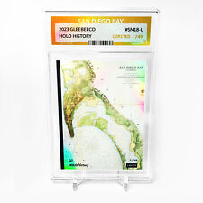
SAN DIEGO BAY 1857 Map Card 2023 GleeBeeCo Holo History #SN18-L /49 $69.00

1857 Map of Iowa | Scott County | Davenport | Iowa Map Reproduction | Iowa Wall $33.99

1857 Map United States|Mexico|Central America|West Indies of the United States o $34.99

1857 Map of Wisconsin | Township Map | Milwaukee and Horicon Rail Road | Wiscons $34.99

1857 Map| Map of Portage Co., Ohio| Cadastral Landowners|Ohio|Portage County|Rea $34.99

1857 Map| Map of Henry County, Indiana| Henry County|Indiana|Landowners|Real Pro $34.99
|


