|

On eBay Now...
1800 Map| Map of two millions acres of land, West Genesee, in the State of New Y For Sale

When you click on links to various merchants on this site and make a purchase, this can result in this site earning a commission. Affiliate programs and affiliations include, but are not limited to, the eBay Partner Network.

1800 Map| Map of two millions acres of land, West Genesee, in the State of New Y:
$34.99
Map Size: 20 inches x 24 inches | Fits 20x24 size frame | Frame not included | Archival Quality Reproduction | 1800 Map|Title: Map of two millions acres of land, West Genesee, in the State of New York : recorded in the names of Wilhem Willink, Nic\'s van Staphorst, Pieter van Eeghen, Hendrik Vollenhoven, Rutger Jan Schinnelpenninck|Subject: Cadastral Indian Reservations|Land Grants|Landowners|New York State|Niagara Frontier|Niagara Frontier N.Y|Real Property|United States Notes: Covers the Holland Purchase territory (Niagara Frontier region in far western New York State). Shows 6-mile-square townships, Amerindian reservations, and areas projected to be sold. Relief (Niagara Escarpment) shown by hachures. Hand col. to show Amerindian reservations in pink and areas to be sold in yellow and green.Each Map is Hand Printed in our StudioFine Art Matte Paper (230g, 14mil) that maintains vivid colors and faithfulness to the original map.Archival inks guaranteed not to fade for 200+ yearsYour map will be shipped in a protective tube via first class mail
Powered by SixBit\'s eCommerce Solution
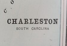
Vintage 1898 CHARLESTON SOUTH CAROLINA SC Map 11"x14" ~ Old Antique Original $35.96

1800 Map United States of the United States: compiled chiefly from the state map $34.99
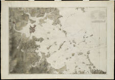
217 Page 1800s NORTH CENTRAL AMERICA NAUTICAL CHARTS Sea Map Photo Book on CD $14.99
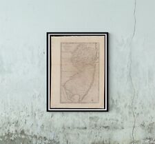
1800 Map New Jersey The state of New Jersey, compiled from the most authentic in $34.99
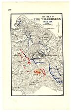
2 Page 1800’s Battle of the Wilderness Maps, US Civil War w/Battle Positions $13.50

Map of Comanche & Other Indians in Texas in the 1800s 11 by 17" $12.99
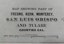
1893 FRESNO KERN MONTEREY COUNTIES CALIFORNIA Map 22"x14" Old Antique Original $50.36
1800'S-1900'S PITTSBURG QUADRANGLE LINEN BACKED MAP - J 5584 $150.00
|


