|

On eBay Now...
16th Century Map of The World 8.5\" x 11\" de Jode Reproduction For Sale

When you click on links to various merchants on this site and make a purchase, this can result in this site earning a commission. Affiliate programs and affiliations include, but are not limited to, the eBay Partner Network.

16th Century Map of The World 8.5\" x 11\" de Jode Reproduction:
$8.12
Yes we combine shipping for multiple purchases.Add multiple items to your cart and the combined shipping total will automatically be calculated.
16th Century Map of The World 8.5\" x 11\" de Jode Reproduction
Size: Approx. 8.5\" x 11\"
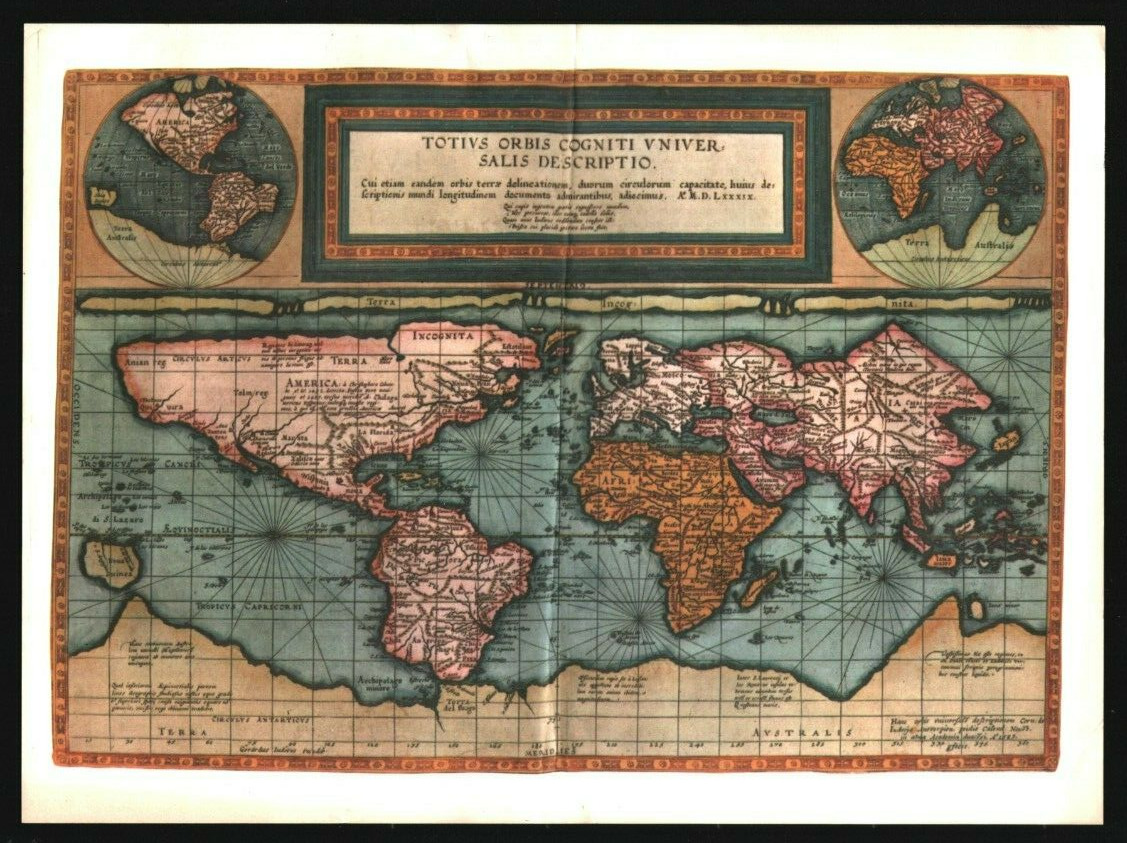
TOTIUS ORBIS COGNITI UNIVERSALIS DESCRIPTOLiterally, \"The Complete Description of the Entire Known World,\"this is a reproduction of one of the rarest printed maps of the16th century. It appeared in one of the earliest atlases, and wasthe work of Gerard and Cornells de Jode, one of the great father-soncombinations of Dutch cartographers.The de Jode atlas, published in 1593, summarized the results of100 years of world exploration, following the discoveries ofColumbus. This map was drawn like the traditional \"sailor’s map,\"with each meridian and parallel spaced an equal distance apart.Shapes and distances near the equator are quite accurate. How-ever, areas and shapes away from the equator—and particularlyin the higher latitudes—become greatly exaggerated. In order tocorrect these distortions, the de Jodes show each half of the worldas a small hemisphere, in circles in the upper corners of the sheet.Having been based on exploration during a relatively short periodof time, the eastern coast of North America, and the Peninsula ofLower California, where most of the explorers had landed, arequite clearly depicted. The interior of the continent, of course, isstill strictly imaginary. The sea routes to the East Indies—botharound Africa by the Cape of Good Hope, and around SouthAmerica by the Strait of Magellan—are geographically correct onthis map. Those shown to the north of Asia and America, however,were to lead many brave explorers to failure and death.14930


Antique Talavera or Toledo, 16th Century Glazed Ceramic Wine Jug 10 3/4” RARE $1600.00

Tudor Gold Ring 16th Century $1091.44

Medieval 16th Century Etched Spanish Full Suit of Armor Knight Crusader Armor $689.00

Rare Tibet 16th Century Old Buddhist Carved Alloy Copper Oil Butter Ghee Lamp $399.00

24" Steel 16th Century Italian Mace 8 flanges $139.95

RARE ANCIENT VIKING BRONZE AMULET JEWELRY ENGRAVED BOX - 16TH CENTURY $59.00

16th Century Three Musketeers Hilt Rapier Full Tang Tempered Battle Ready Forged $169.99

16th Century Italian Cup Hilt Rapier $3400.00
|