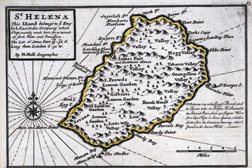
Map of St. Helena Island
- 17th century
Used as a watering stop for East India Company ships and as a location from which the Royal Navy could dominate the South Atlantic, St. Helena was a mountainous tropical island a mere 28 miles in circumference. The nearest land, the west coast of Africa, was 1,140 miles away. A buoy lost in the South Atlantic, it was hell on earth for a man of Napoléons active temperament.
Historical Provenance - Ink on paper

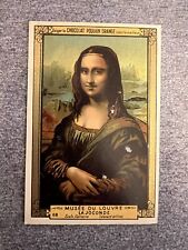
1880âs Poulain-Louvre MONA LISA DA VINCI RC Rookie / 1st Card (Stollwerck) Pop 0
$100000.00
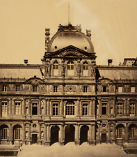
Gustave Legray, Louvre vintage print, cardboard size: 64 x 48 cm print al
$5327.75
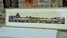
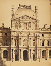
KENNETH SNELTON (1927-2011) RARE L.A. LARGE PONORAMIC PHOTOGRAPH LOUVRE,PARIS
$2850.00

Cheret poster department stores du Louvre Etrennes 1897 | Jules Chéret | good condition
$2131.10
Baldus, vintage Louvre print, cardboard size: 56 x 46.5 cm albumin print
$2131.10

Medicom BE@RBRICK Louvre Leonardo de Vinci Mona Lisa 1000% Bearbrick Figure
$1800.00